
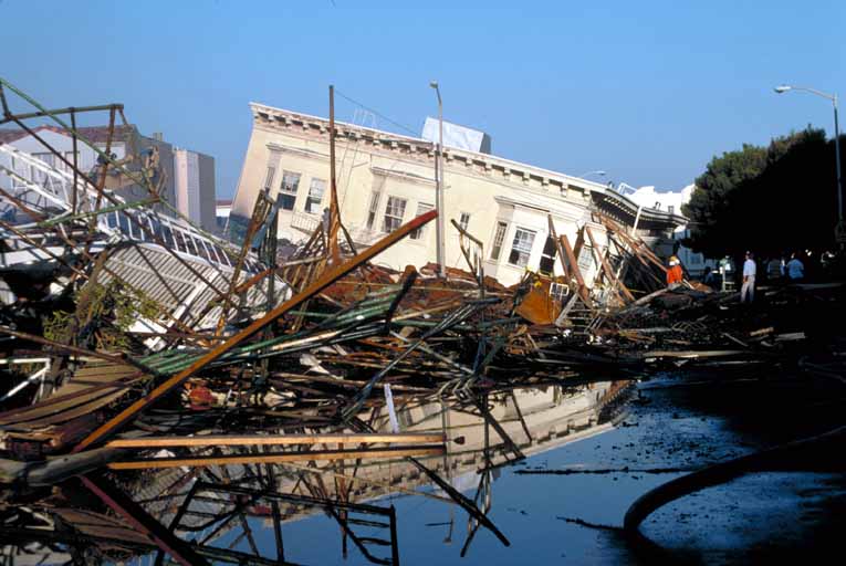
This was the day when, in 1906, San Francisco changed forever, with a 7.8-magnitude earthquake and subsequent fires leveling most of the city. Photography from that grim two-or-three day span presents an almost apocalyptic vision of the past. What we have here (preserved by institutions like the SF Public Library, US Geological Survey, and UC … Continue reading A Photo Tour Of the Great Earthquake
Tag: Earthquake
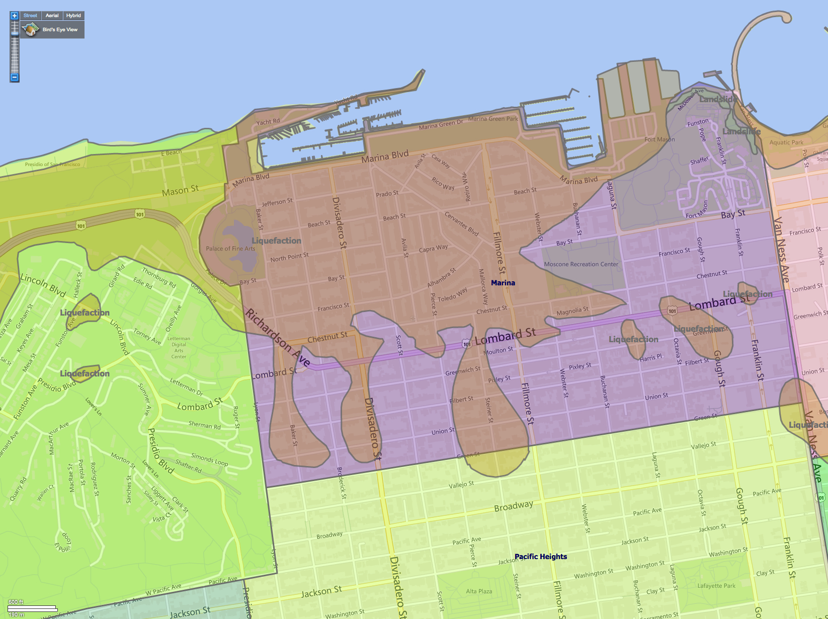
The Latest SF Liquefaction Zone Maps (for those who must know)
Did you feel it? At about 7:30 PM last night, the US Geological Survey recorded an earthquake below one corner of El Cerrito’s Sunset View Cemetery, about 4.9 kilometers down. (That’s three miles, more or less.) It was really just a little bump and rattle, measuring 2.5 on the Richter scale–barely worth noticing, although people … Continue reading The Latest SF Liquefaction Zone Maps (for those who must know)
We Answer Everyone’s Questions About San Francisco
People have questions about San Francisco, and we’ve got the answers. People use Google for all sorts of things, including trying to find information about our bayside city; some queries are everyday, some are highly specific, and some are even a little weird, but all of them are needful to one degree or another. We … Continue reading We Answer Everyone’s Questions About San Francisco
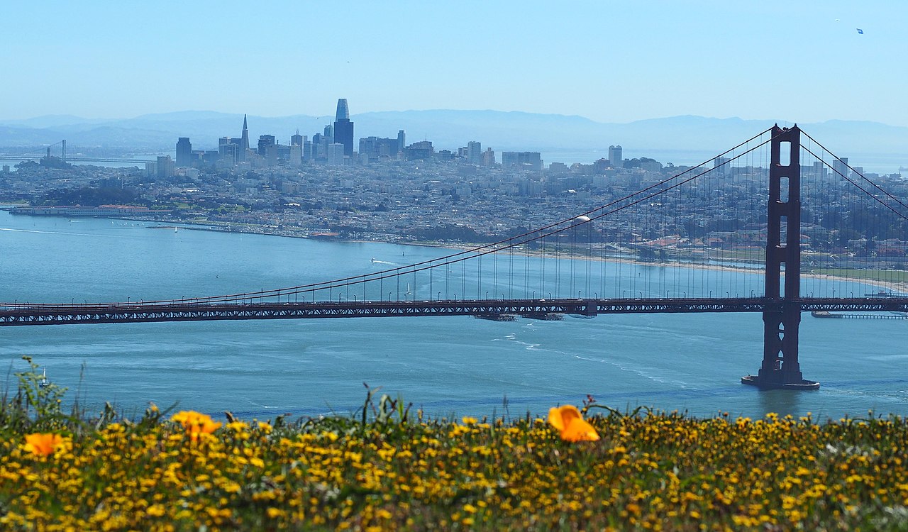
The Anxious Homebuyer’s Guide To San Francisco Earthquakes
Last week we got an email from some potential San Francisco homebuyers fretting about–what else?–the risks of living in a major fault zone and the danger posed by certain neighborhoods and certain kinds of homes in the event of a major earthquake. Along with the cost of living, this is probably the number one thing … Continue reading The Anxious Homebuyer’s Guide To San Francisco Earthquakes
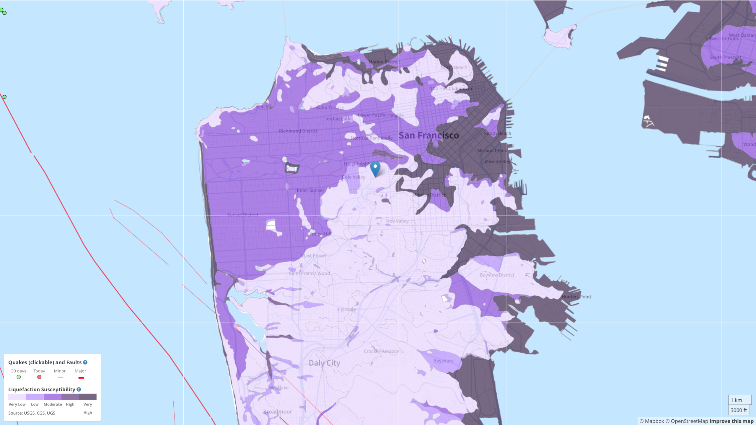
Bay Area Liquefaction, Landslide, and Seismic Zones – Mapped
Lots of talk in the news these days about landfill, liquefaction, and general stability of property in and around San Francisco’s waterfront, and entire city for that matter (see “SF’s landmark tower for rich and famous is sinking and tilting“that hit newsstands and internets today [SF Gate/Chronicle]). Big news, no doubt, but what about the … Continue reading Bay Area Liquefaction, Landslide, and Seismic Zones – Mapped
San Francisco Neighborhoods Prone To Liquefaction And Earthquake Induced Landslides (Bedrock vs. Landfill Take Two)
Back on February 15th, 2008 (yes, theFrontSteps has been around that long) we were asked by a reader if we knew of any good maps showing areas in San Francisco that are either bedrock or landfill. You’d be amazed how many people, to this day, read that post, and how many more emails we get … Continue reading San Francisco Neighborhoods Prone To Liquefaction And Earthquake Induced Landslides (Bedrock vs. Landfill Take Two)